


Thanksgiving In A Restoration Corridor
A Southside Surprise

In June 2020, four months into the pandemic, our emerging coping strategy grew to include participating in various virtual classrooms focused on Texas natural history. Tapping into the resources of the Native Plant Society of Texas, Travis Audubon, and the Lady Bird Johnson Wildflower Center broadened our appreciation of the local landscape, adding a dimension to our trail wanderings. In early September a presentation on “pocket prairies,” or defined areas of native plant restoration, sparked an interest in local rewilding efforts.
Soon after the presentation, while reviewing a map of eastern Travis County, I noticed map labels for the Decker Tallgrass Prairie Preserve and the Barrera Indiangrass Wildlife Sanctuary, both bordering Walter Long Lake and both sounding like rewilding or conservation efforts. Further investigation uncovered that these City of Austin sites were established to protect native prairie plant species. While not open to the public, there were hints that the spaces could be visited by appointment.
Curious about such a visit, I emailed the city’s Parks and Recreation Department, but heard nothing back until right before Thanksgiving when Matt McCaw, Land Management Program Manager for the department, kindly wrote informing us that the sites were closed during the pandemic. He did suggest, however, that if interested in prairie restoration, we should visit the Slaughter Creek Trail near Dripping Springs, a spot managed by Austin Water Utility’s Wildland Conservation Division.
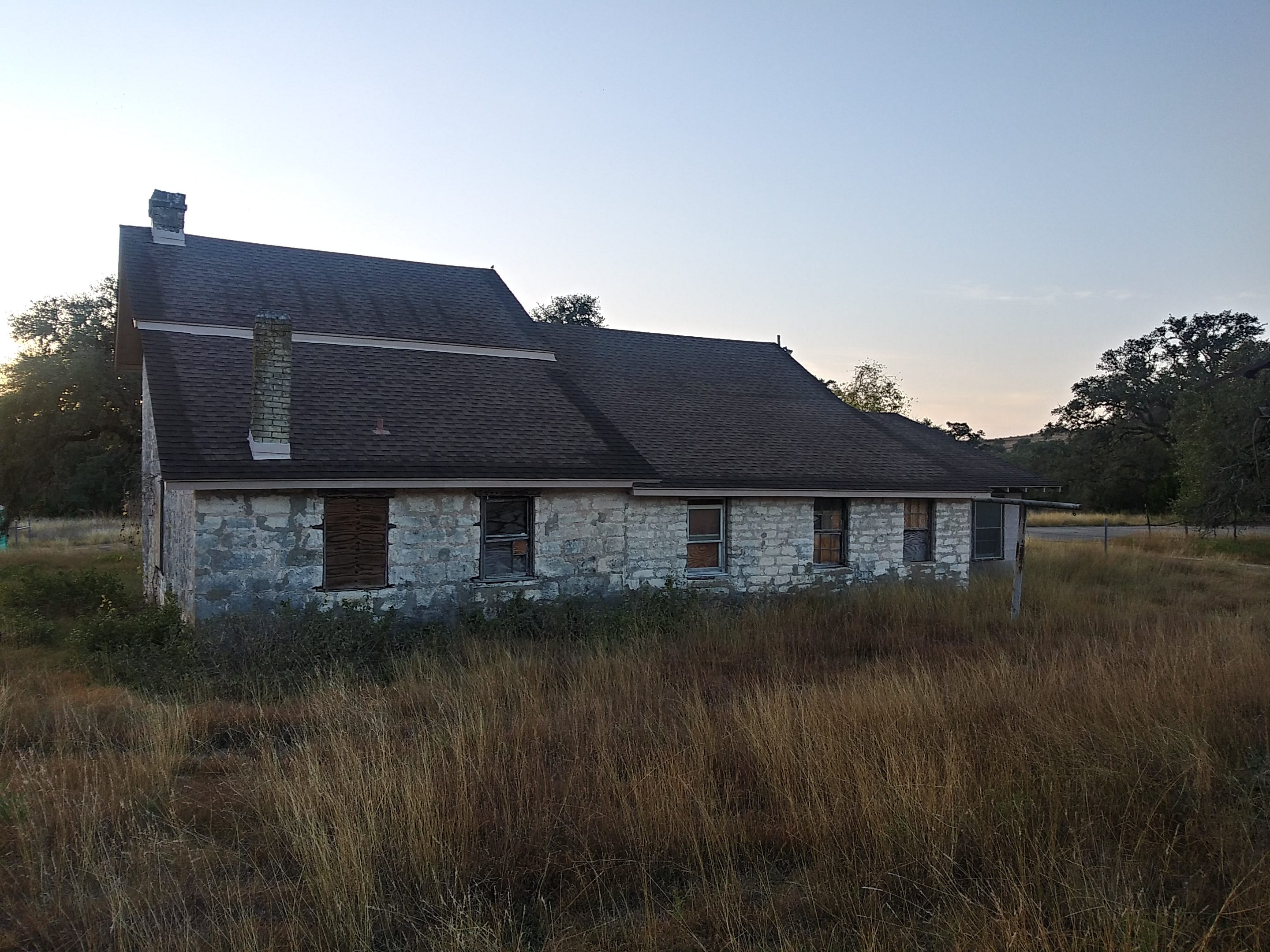
The above is long-winded introduction to why, at daybreak on Thanksgiving, Kim and I headed south of town and found the Slaughter Creek Trail off FM 1826 heading towards the Salt Lick BBQ. Pulling in through site’s property gates, marked only with sign indicating you are entering a Water Quality Management Area, we were greeted by the Trautwein Homestead. Occupied as early as 1858 and buttressed with walls of thick limestone, the home would have been on the frontier of Texas during the Civil War. This spot was long a working ranch and for the past twenty-plus years has been managed as public lands recharging the Barton Spring segment of the Edwards Aquifer.
Located in a region stressed by rapid suburbanization, the Slaughter Creek Trail was developed a little more than a decade ago. The trail is a loop, with hikers heading in one direction, mountain bikers in the opposite. If on foot you will meet cyclists who are encouraged to yield to walkers, but in our experience such courtesy was rare. At times you must listen as much for sprockets spinning as for the birds whistling. Getting an early start minimizes trail congestion, with the rising sun helping to awaken and stretch the senses.
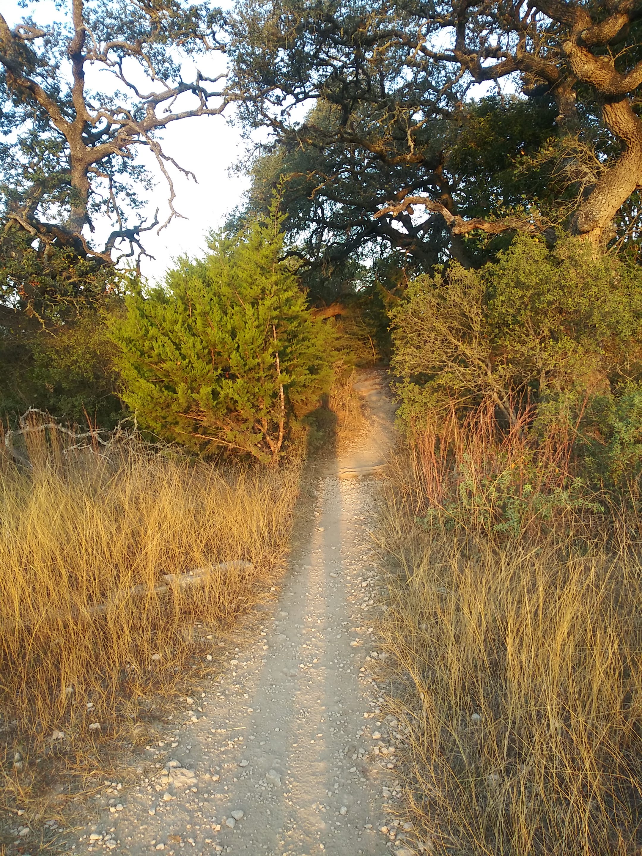
As you wander the trail and traverse the limestone outcrops, cutting through prairie grass and woodland settings, you encounter excellent examples of the “benches” of the Glen Rose Formation. Named after the town of Glen Rose, where the formation is home to many dinosaur tracks, the sedimentary units weather into an alternating bench and slope topography that is its geological calling card.

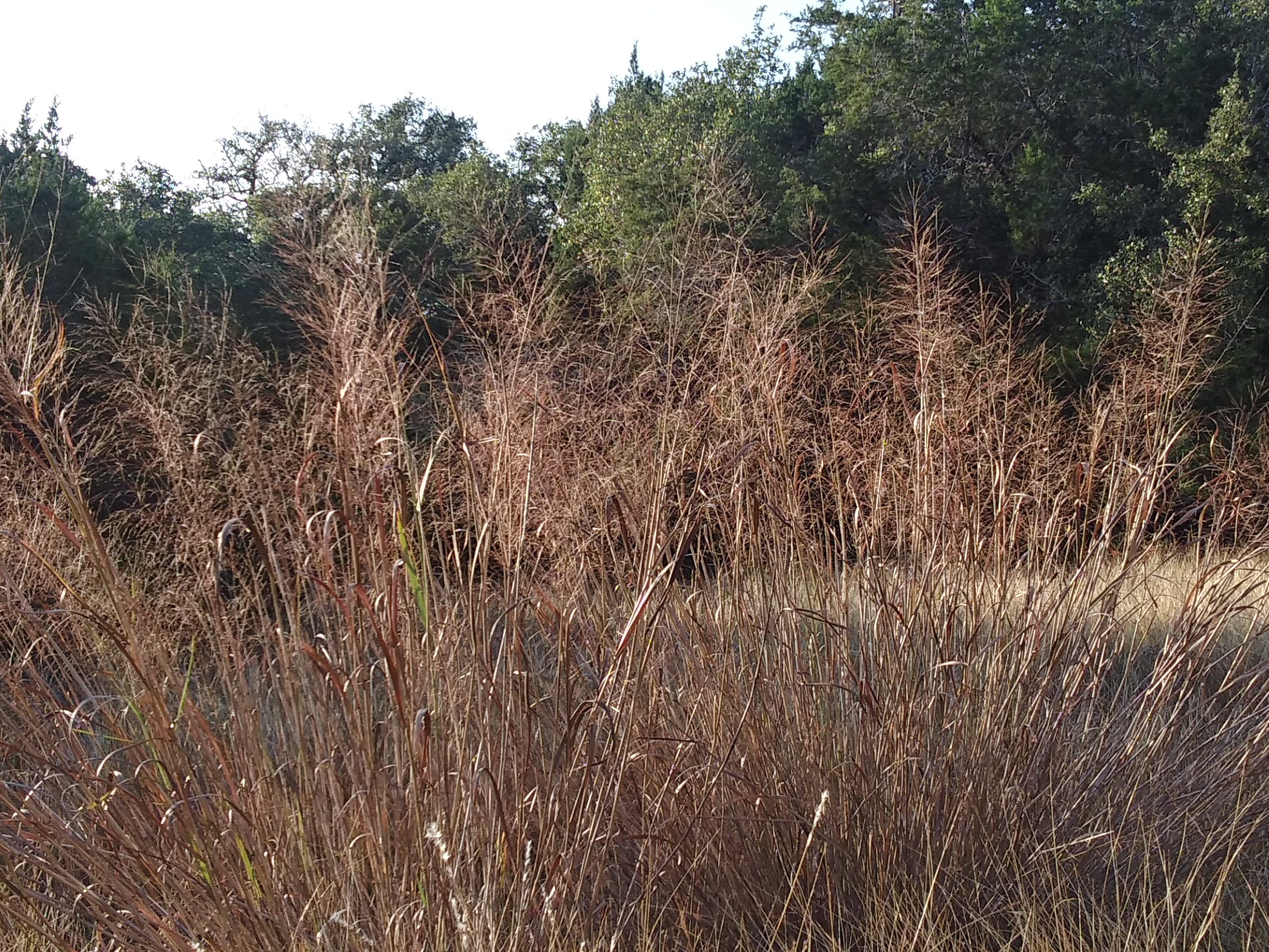
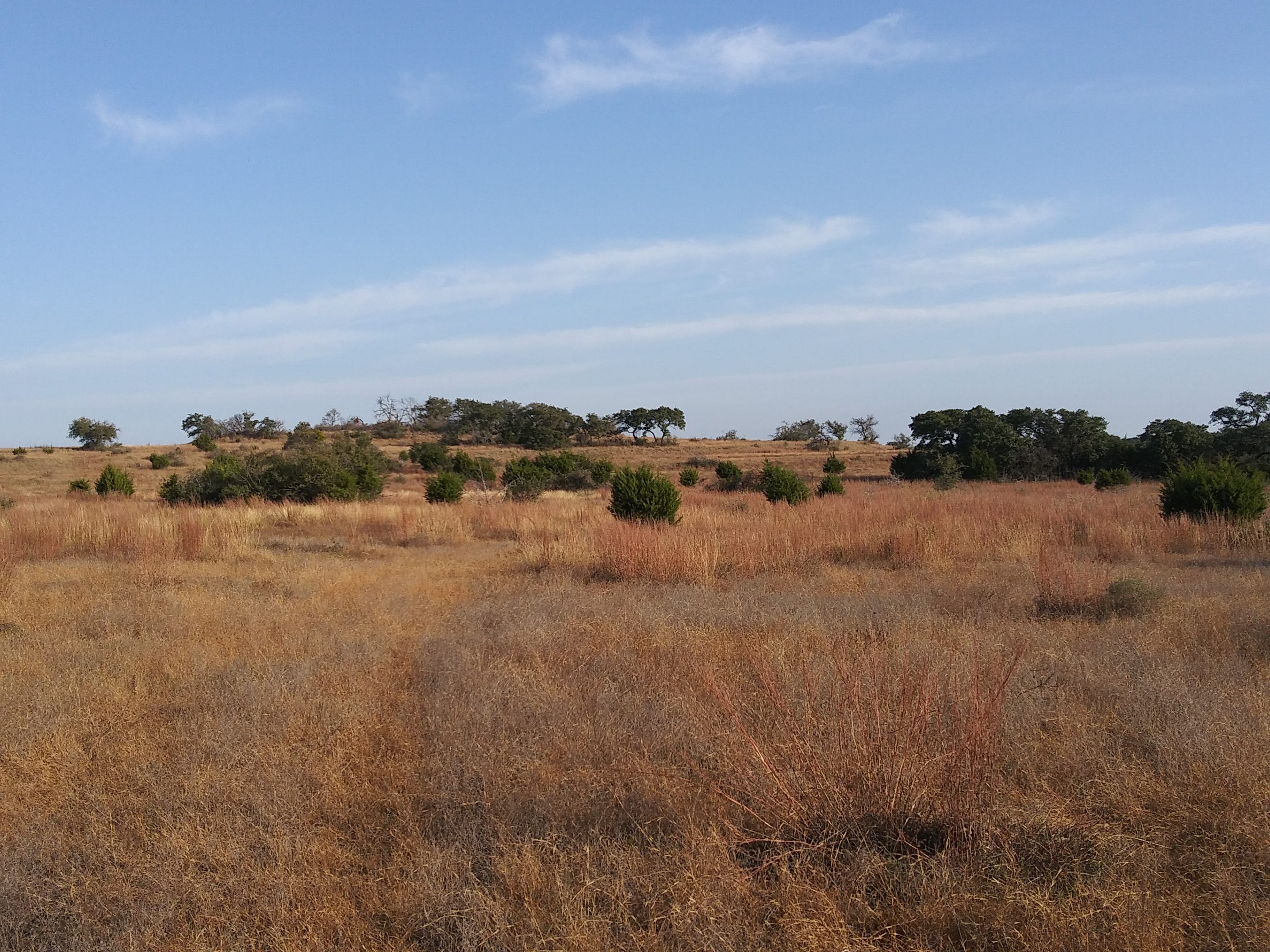
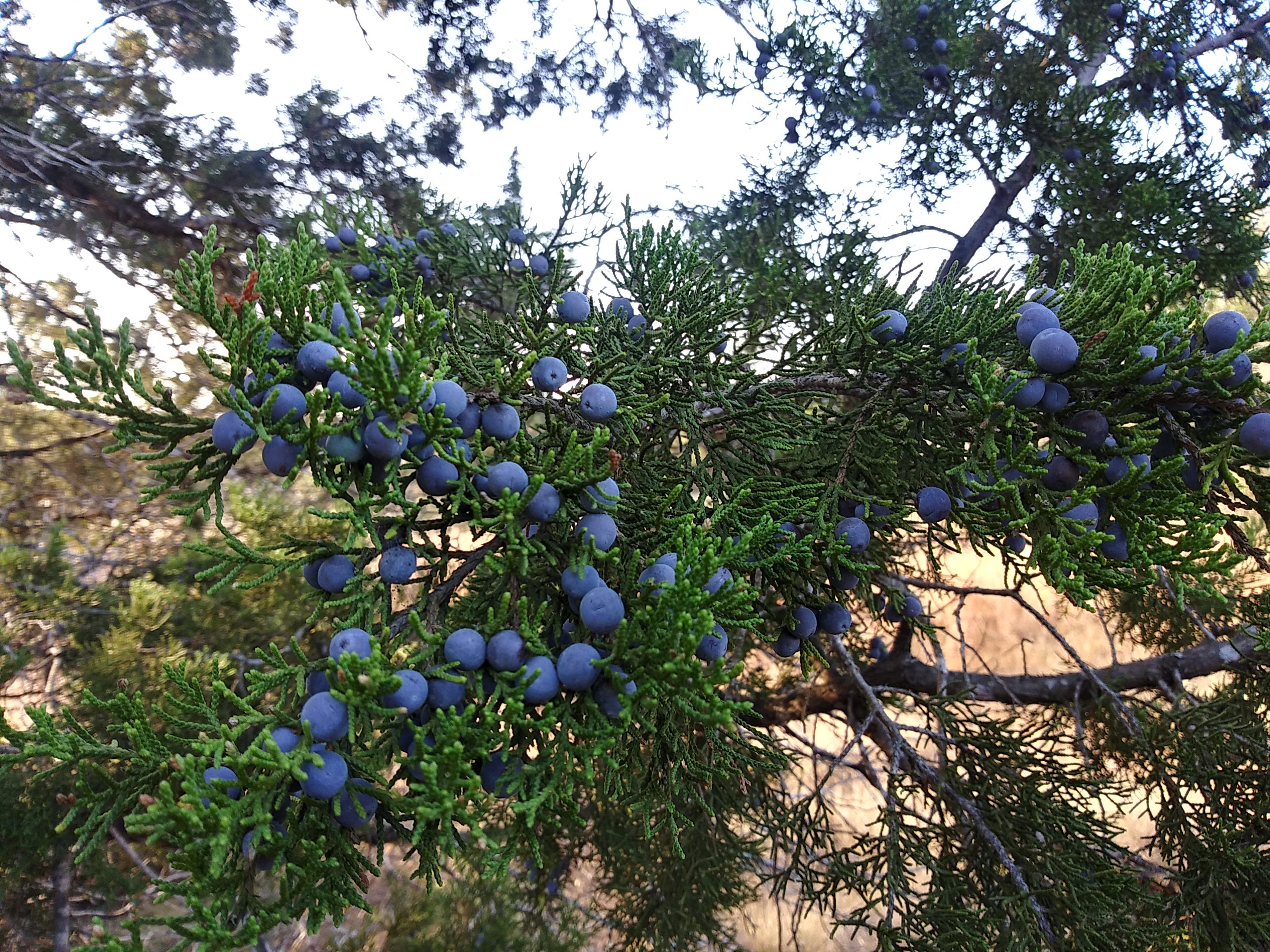
In some areas, the trail enters woodland thick with native cedar, a dominant species that thrived with the rise of ranching and the subsequent curbing of natural fires. Over time, the cedar spread, usurping the grasses, hogging water resources, and transforming the local ecology. The current stewards of the land have done a remarkable job of using controlled burns to weed some areas of the cedar and let the native plants, particularly grasses, return. The result is a precolonial landscape owning the label Post-Oak Savanna.
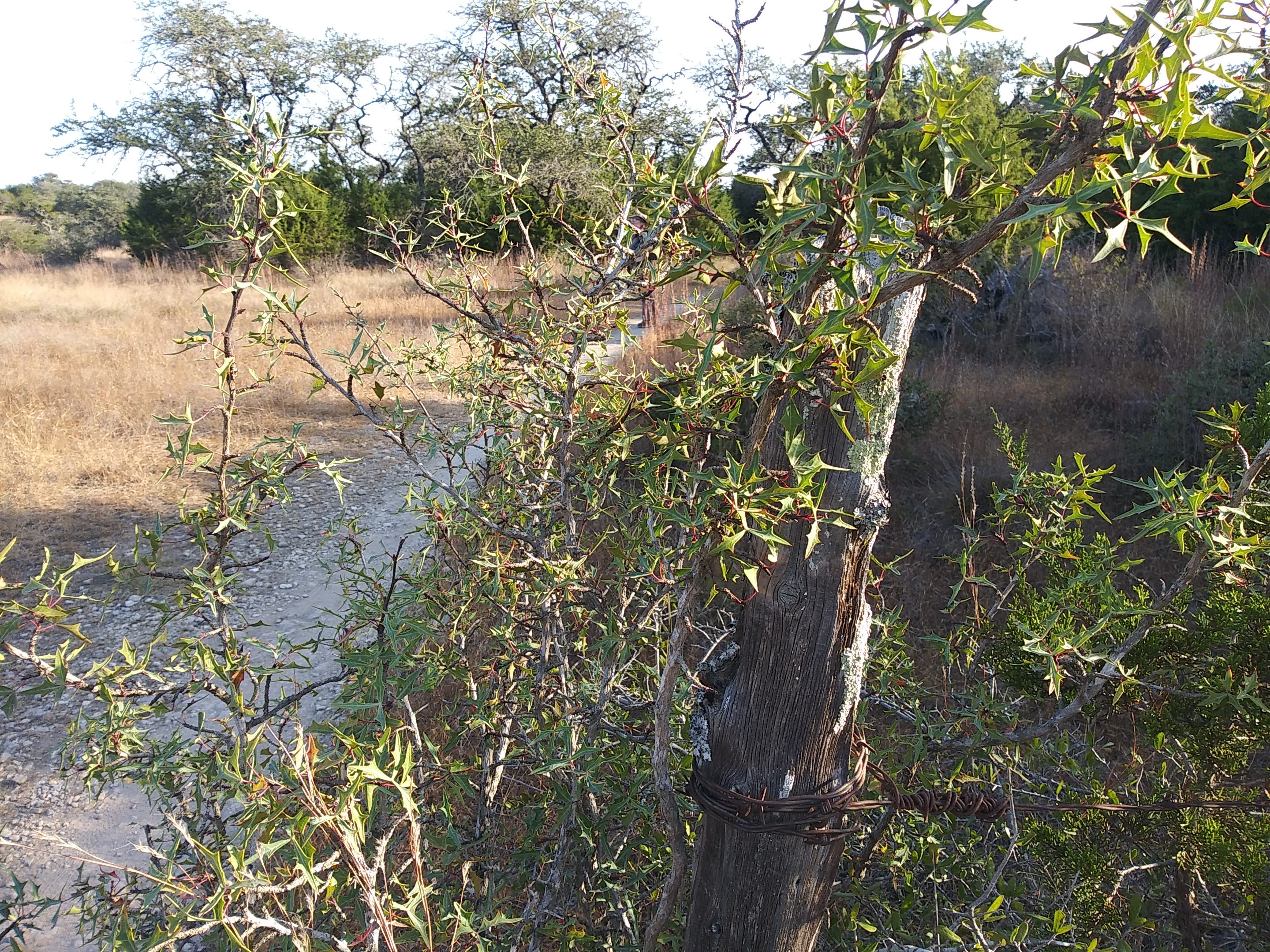
The restoration efforts are more than nostalgia for an earlier aesthetic. Reducing the impervious cover and rewilding the land repairs a degraded riparian corridor. The return of native grasses, with their deep roots, helps reduce the soil density so water can flow more easily to the limestone conduits feeding the aquifer recharge zone. Alongside these restoration sites, remnants of past ranching and homesteading activities pepper the landscape. Cedar fence posts with century-old barb wire wrapped in Agarita are tucked away within eyesight of the trail. The homestead trash heap, with a curious mix of discards, is codified as an archaeological landmark, complete with interpretive signage.
Landing back at the parking lot after a couple of hours wandering the trail, we returned home with questions, most centered on basic grass identification. Was that a muhly, a blue stem, or a grama? You can view the seed heads, study the stalk patterns, and use field guides to narrow your selections, but the task is not simple. The variety of species on the trail, combined with the nuances of differentiation, reinforced our status as amateur enthusiasts, content with our not-always-successful efforts. In many ways, these identification attempts, while increasing our knowledge base, are less important than simply getting out and walking the land. As our friend Andrew once commented, “The outside is the right side.” With that sentiment in mind, we are eager to return to the trail where we will feel the ground underfoot, watch the limestone formations sculpt their history, and simply listen for the grasses to tell their stories. We will even give some love to the cedar with its striking berry-like seed cones and be always thankful for these local efforts at rewilding.
Great find James and Kim! I remember that my mom talked about Algarita jelly that my uncle used to make - in case you want to try that some time! I especially appreciate your touches of the geological record.